March 28 – A 240 km drive to Punakaki, on the west coast, took about 4 hours. The road first took us through some very green agricultural land with many ranches, farms and vast forests of timber to be harvested. At about the half way mark, we went into a mountainous area with the road winding back and forth with many hair-pin turns. It was slow going but very pretty. The last part of the trip was down the coast with sweeping views of waves crashing on the rocky coast. We checked in to the Blowhole Cottage at the Paparoa Park Motel where we had a nice bedroom and a large kitchen / dining / living area with great views up the coast. The sitting room was comfortable and the kitchenette was handy for making breakfast or tea. It was a quiet spot to relax after a day out, with the ocean visible from the windows.
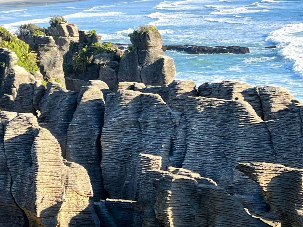
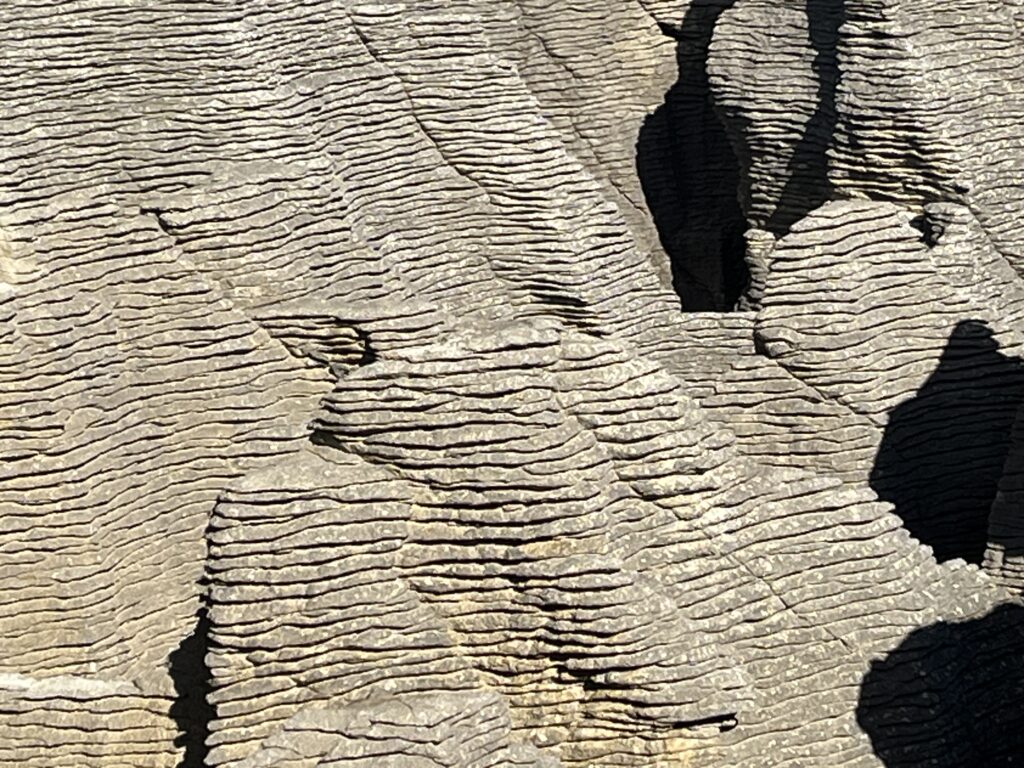
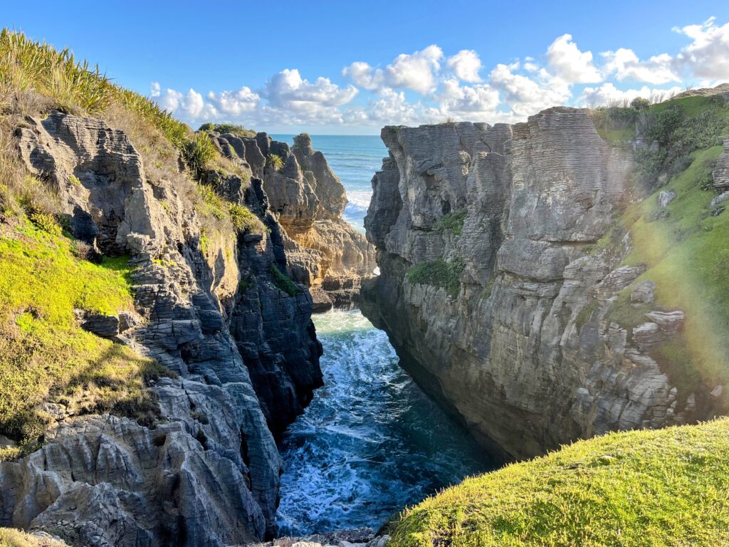
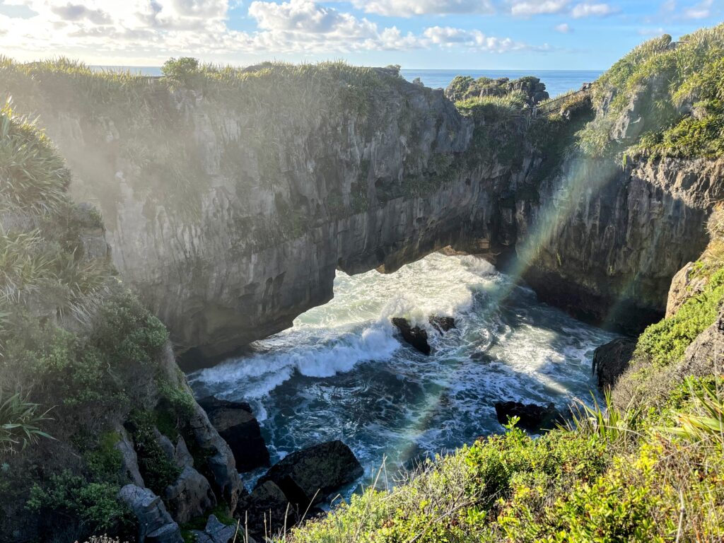
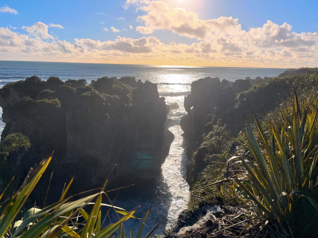
The main draw in Punakaiki is the Pancake Rocks at Dolomite Point. These strange, stacked limestone formations really do look like piles of thick pancakes. What’s fascinating is how they formed: over 30 million years ago, layers of marine creatures and sand settled on the ocean floor. Over time, immense pressure solidified these layers into limestone. Earth movements lifted them above sea level, and then wind, rain, and the relentless Tasman Sea eroded the softer layers, leaving behind the distinctive “pancake” stacks you see today. Walking the loop track, you can see the horizontal banding in the rock up close, and at high tide, the blowholes put on a show as waves force water up through narrow vents. They had a very nice visitor center and the walk was an easy 1/2 mile loop.
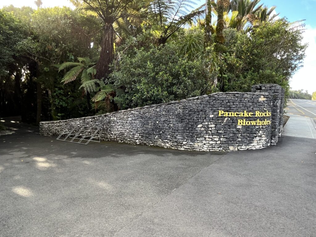
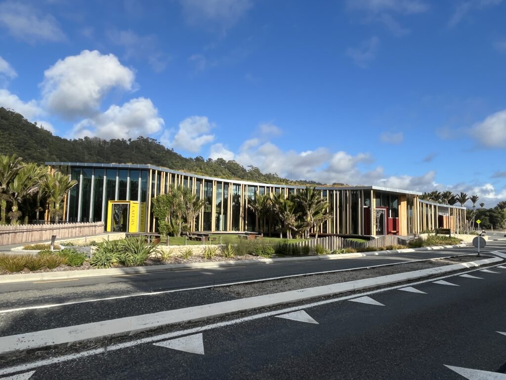
Across the street is a very nice visitor center.
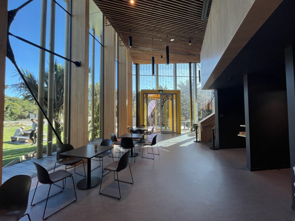
You could watch movies about the local geology and the formation of the ‘pancakes’, get pizza and beer, and of course, buy all sorts of touristy stuff.
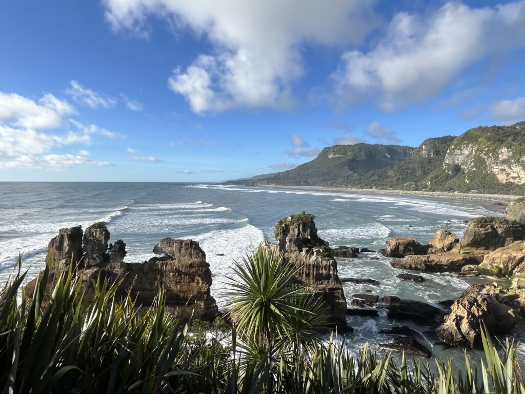
A beautiful, rugged coastline.
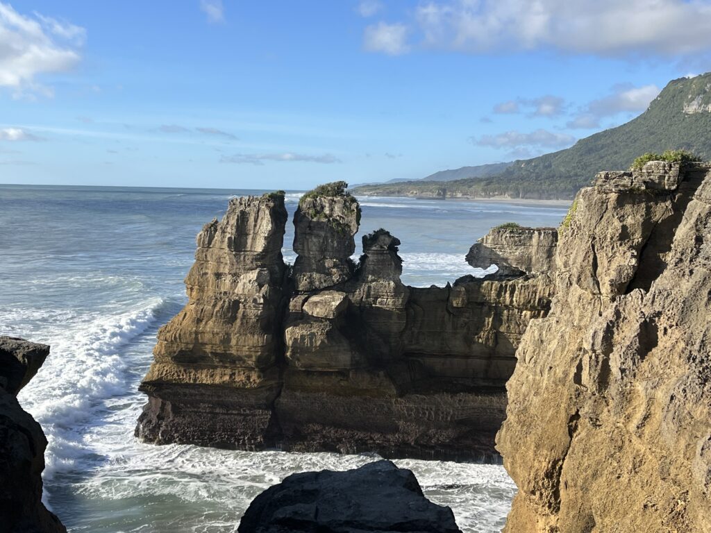
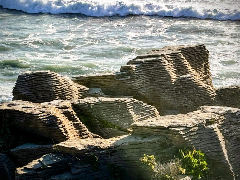
And the main attraction – the ‘pancakes’!
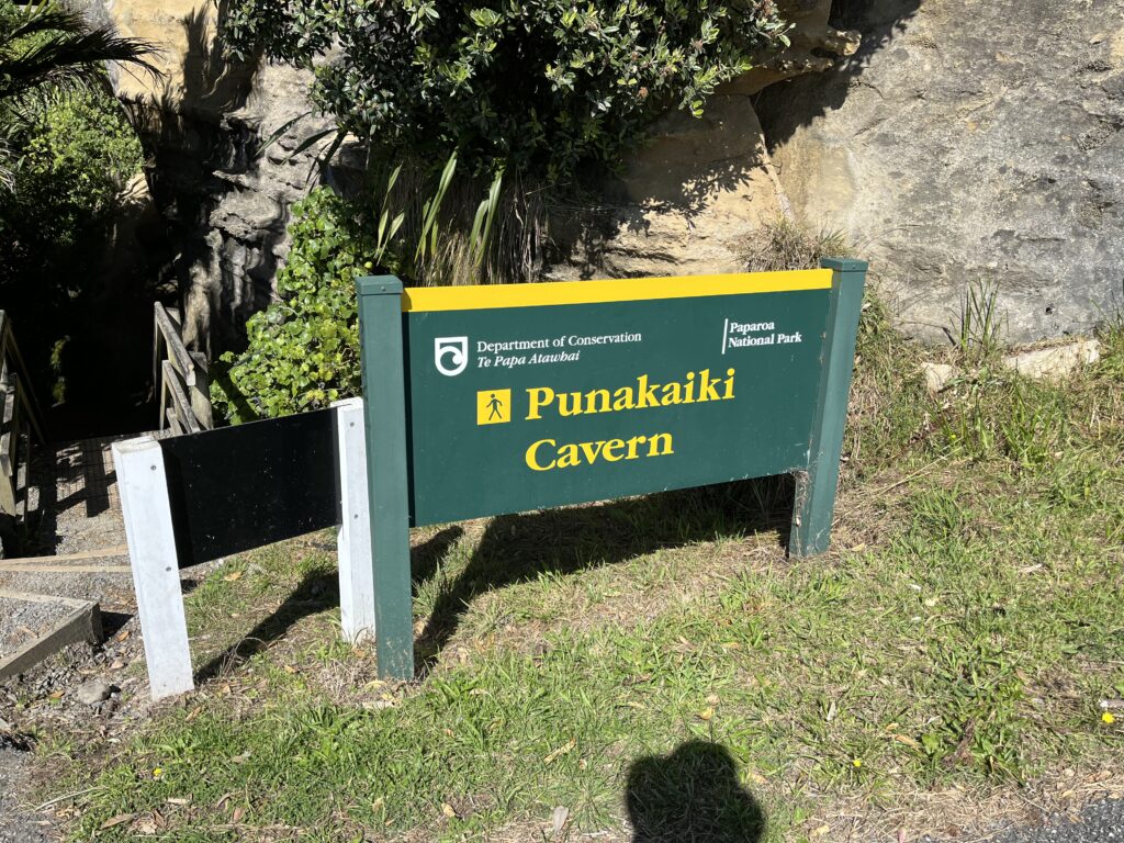
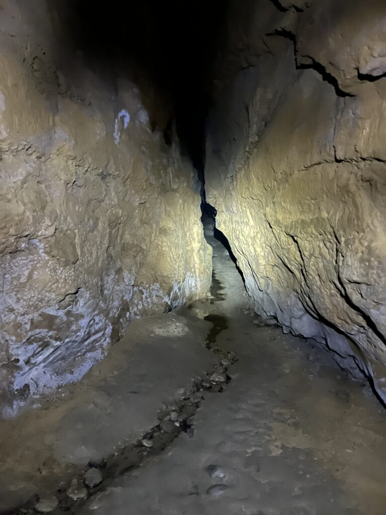
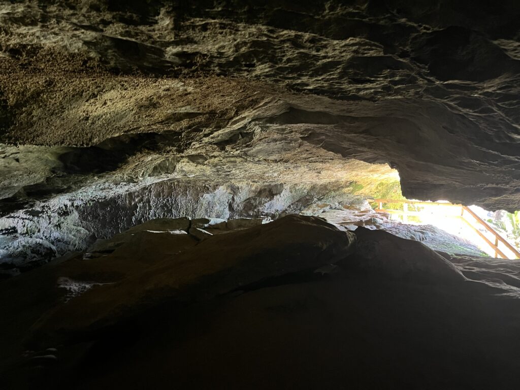
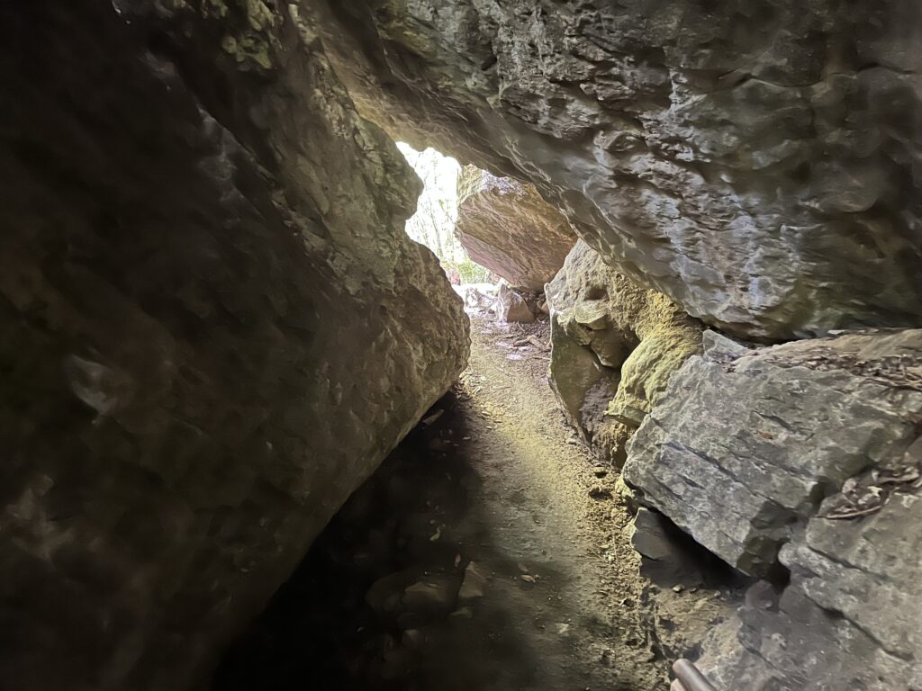
With Peggy still recovering from pneumonia, I took some time to check out the Punakaiki Cavern, a short walk from the main road. It’s a small cave, easy to explore with a flashlight or headlamp, and a nice break from the wind on the coast.

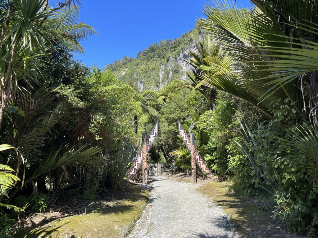
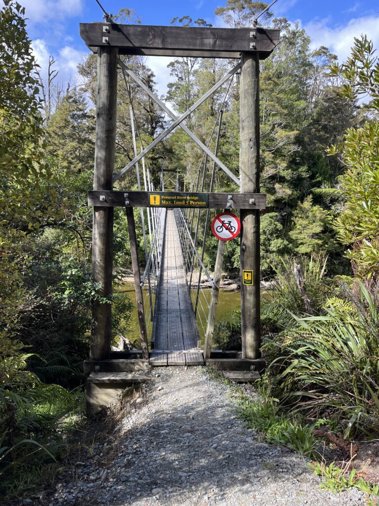
After the caverns, I went to check out the Pororari River Track, a 5-mile hike through dense forest, following the river between high limestone cliffs. The trail is mostly flat and easy, with plenty of spots to stop and take in the scenery or snap a few photos. Along the way, I spotted several large eels in the river, some over three feet long, gliding slowly through the clear water.
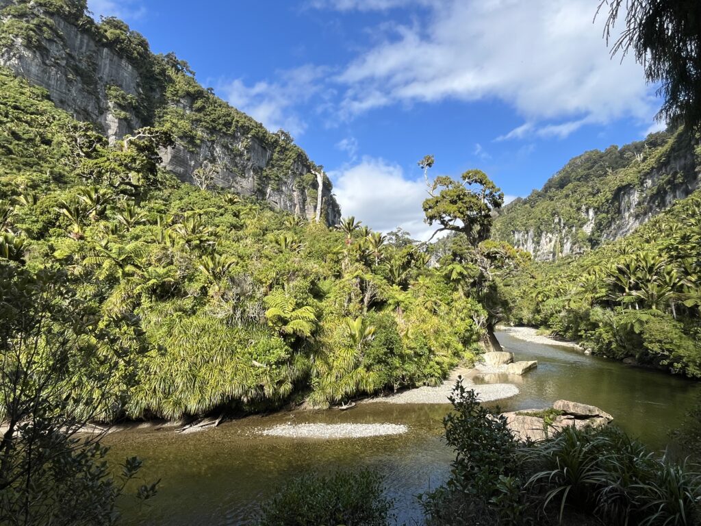
The river gently flows between steep cliffs, towards the Tasman Sea.
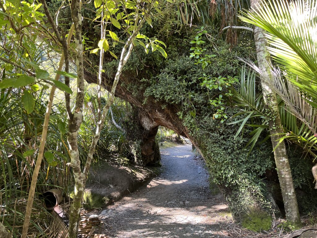
Much of the trail had a beautiful limestone cliff towering above. At times the trail tunneled through outcroppings or went on suspended walkways.
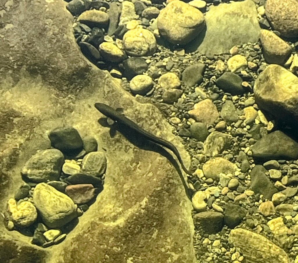
The New Zealand longfin eel (Anguilla dieffenbachii) is the country’s largest and only endemic freshwater eel, found throughout rivers, streams, lakes, and wetlands—even far inland thanks to their remarkable climbing ability as juveniles. Longfin eels are exceptionally long-lived, with females often reaching maturity between 27 and 61 years old (and sometimes living over 80 years) before making a single, epic migration thousands of kilometers to the tropical Pacific near Tonga to spawn and then die. Their eggs hatch into larvae that drift back to New Zealand on ocean currents, a journey that can take up to 15 months, before transforming into transparent “glass eels” and migrating upstream to begin the cycle anew. Opportunistic nocturnal predators, longfin eels feed on insects, fish, crayfish, and occasionally small birds, and are culturally significant to Māori as a traditional food source. Despite being widespread, their numbers are declining due to overfishing, habitat loss, and barriers to migration, making large adults increasingly rare and earning them a conservation status of “At Risk – Declining”.
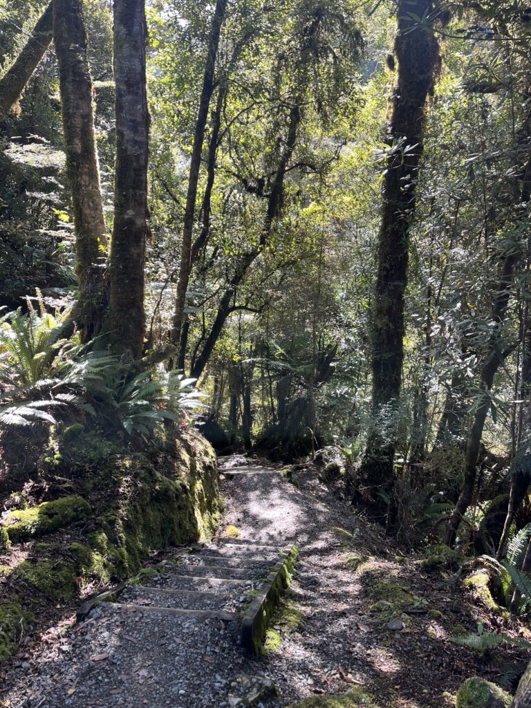
The whole area was a lush temperate rain forrest. Steep terrain with the dense growth of trees, mosses, ferns and vines made it look fairly impenetrable off the trail.
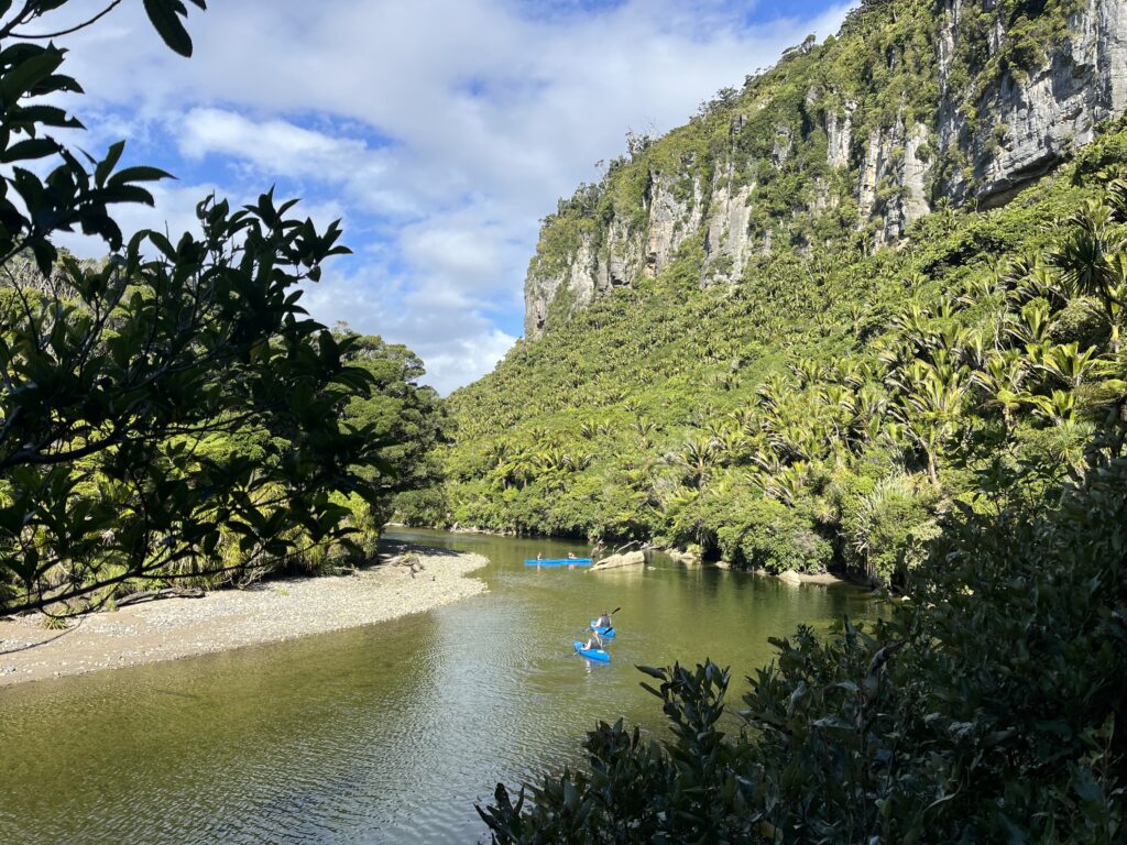
There were a few groups of kayakers coming down the mostly calm river, enjoying the peaceful surroundings with occasional, more challenging rapids.
A Local Surfing Scene
On my way back from the hike, I happened upon a local surfing competition. The leaderboard was a piece of cardboard, hand-lettered with a Sharpie, propped up near the beach. The whole event felt more like a neighborhood party than a formal contest—music played from portable speakers, there was a BBQ going, and coolers full of beer were here and there. The prize for the top woman was $1500, while the men’s winner got $5 and a beer, which got a lot of laughs. People were focused on the competition, everyone cheering each surfer, although it seemed that the loudest cheers were earned by the most spectacular wipeouts! It was a good time and a reminder that in small towns, it’s the community that makes the event.
Punakaki is a small place, but between the unique geology, the friendly local scene, and the wild coastline, it’s well worth a visit. If you’re passing through, take your time—there’s more here than first meets the eye.
References:
Lollybet Casino Betrug http://maps.google.bi
References:
Lollybet Aktionscode https://js.11467.com
References:
Lollybet Casino Test board-bg.seafight.com
References:
Lollybet Bewertung http://cse.google.bg/url?sa=i&url=https://encurta.bio/ehztania10
References:
Australian pokies payid https://cyberdefenseprofessionals.com/companies/understanding-payid-gaming-banking-solutions-a-contemporary-financial-revolution-axlum/
References:
Pokies net australia payid withdrawal https://careers.cblsolutions.com/
References:
Payid withdrawal pokies https://giaovienvietnam.vn/employer/best-payid-casinos-in-australia-for-july-2026/
References:
Online pokies with payid australia real money git.saf.sh
References:
Hitnspin casino app android http://images.google.az/url?sa=t&url=https://ontrip.80gigs.com/profile/swordtemper4/
References:
Hitnspin casino alternative http://cse.google.am
References:
Hitnspin casino willkommensbonus http://cse.google.com.mt/url?sa=t&url=http://amur.1gb.ua/user/bettyarea7/
References:
Lollybet Casino Betrug http://cse.google.ci
References:
Lollybet Promo Code https://tdec.tn.gov/single_signon/Account/LogIn?returnurl=https://kaptur.su/proxy.php?link=https://lollybet.com.de/
I think this is one of the most vital info for me. And i am glad reading your article. But should remark on some general things, The site style is ideal, the articles is really excellent :D. Good job, cheers
References:
Hitnspin casino bewertung http://electrik.org/
References:
Hit n spin casino bonus http://taxref.i3s.unice.fr/describe/?url=https://birdloss66.werite.net/bonus-900-hitnspin-casino-spielen-online-o-deutschland
References:
Hitnspin bonus code http://forum.xnxx.com/proxy.php?link=https://moonlinky.com/chassidymi
References:
Hitnspin casino live http://optimize.viglink.com
References:
Hitnspin casino bonus code https://www.hungaricana.hu/hu/kapcsolatfelvetel/?source=KT_EGER&record=https://gamemania55.com/yasu_gamech/forums/users/peonysheep2/
References:
Monro Casino Automatenspiele stat.profintel.ru
References:
Hitnspin casino mobile http://s0565755c.fastvps-server.com/
References:
KingMaker Casino Einzahlung mit Prepaid https://wiki.opencellid.org/
References:
Kingmaker Casino Mindesteinzahlung http://electrik.org/forum/redirect.php?url=https://sbfpageing.com/cuwle
References:
KingMaker paypal einzahlung images.google.ac
References:
KingMaker Casino 1 Euro Einzahlung https://www.rufox.com/go.php?url=https://tinyurl.ee/franklinhartighttps://www.rufox.com/go.php?url=https://tinyurl.ee/franklinhartig</a
References:
Kingmaker casino echtgeld spielen einzahlung https://smolbattle.ru/proxy.php?link=https://jagoan-hosting.online/temekaducroz1
References:
KingMaker Casino Einzahlung mit Paysafecard http://maps.google.by
References:
KingMaker Casino Willkommensangebot http://alt1.toolbarqueries.google.vg/url?q=https://de.trustpilot.com/review/beyondjewellery.de
References:
Kingmaker Casino PayPal http://kimberly-club.ru/
References:
KingMaker Casino Ersteinzahlungsbonus digitalcollections.clemson.edu
References:
KingMaker einzahlungslimits https://antoniofradique.net/perrybest40710
References:
KingMaker Casino Einzahlungsbonus 200% wsurl.link
References:
Kingmaker casino sichere einzahlung https://tinyurl.ee
References:
Legiano Casino VIP https://semanticweb.cs.vu.nl/verrijktkoninkrijk/browse/list_resource?r=https://link.1hut.ru/kristancamden
References:
Legiano Casino http://67.pexeburay.com/index/d2?diff=0&utm_clickid=00gocgogswows8g4&aurl=https://de.trustpilot.com/review/edelkranz.de
References:
Legiano Casino Deutschland http://orienteering.sport/go-to/?url_to=https://sysurl.online/alexandriaalge
References:
Legiano Casino Echtgeld https://myseldon.com/away?to=https://de.trustpilot.com/review/edelkranz.de
References:
Legiano Casino Jackpot http://images.google.cz/
References:
Legiano Casino Deutschland http://forum.russ-artel.ru/proxy.php?link=https://jogabingogratis.com/marquisbohanno
1ezxkl
iq3wve
hjn08o
rhkqbn
44uocb
The natural landscape of New Zealand is breathtaking.